


|
|
|
|
Dec 15 -Thur. We leave Cusco early headed for the starting point of
our Inca Trail Hike, ultimately to finish in about a week at Machu Picchu. It is
a 4 hour drive from Cusco to the starting point of our first hike. Along the way
we stop at Limatambo to see the Tarawasi Inca ruins. This region was valued by
the Incas for its many micro-climates permitting the diversity of crops from
potatoes to sugar cane. The lands were later held by the Spanish landowners who
used the indigenous people to provide labor for the crops. In the ’60s when the
land was nationalized, the local people received plots of land and learned what
it meant to manage their own farms.
We make it back to the lodge in time for lunch and a hot shower, Jon takes a
message in the afternoon to limber up those pesty calf muscles for the long hike
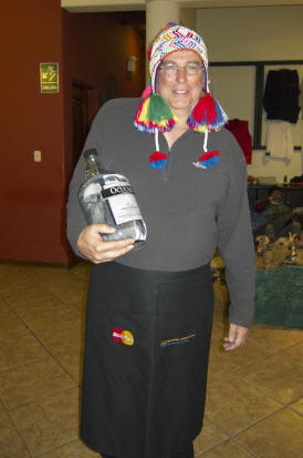
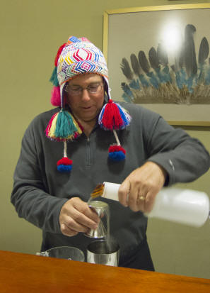
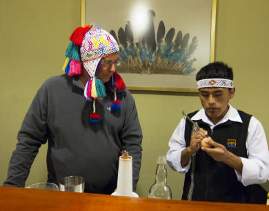
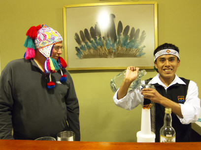
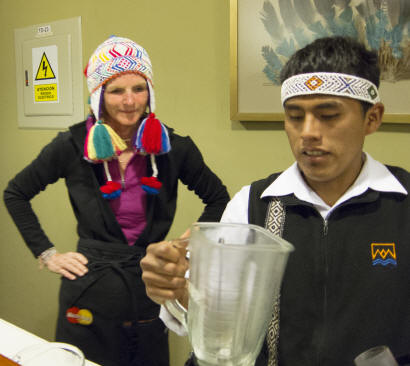
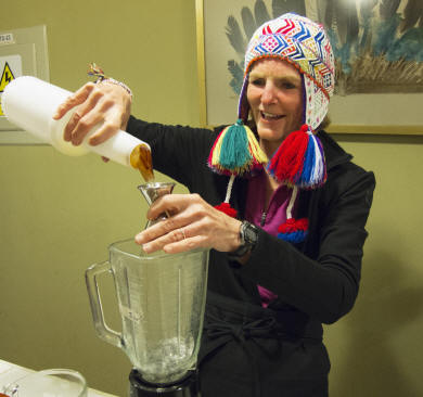
tomorrow. Before our dinner, our bartender, Michael, introduces us to the fine
art of Pisco and how to make Pisco sours. In order to be in the right spirit, we
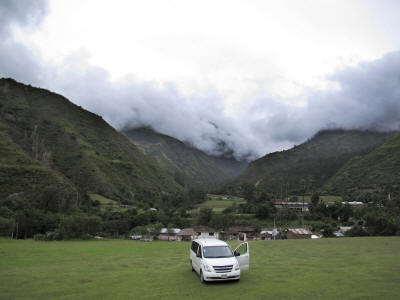
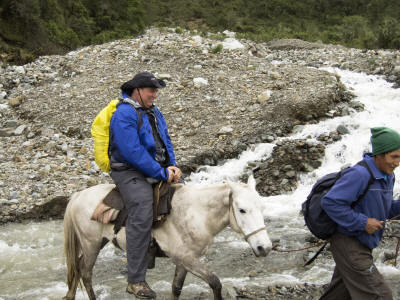
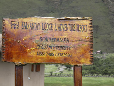
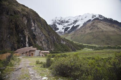
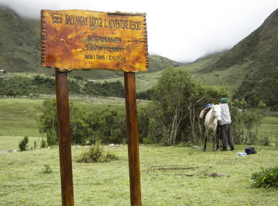
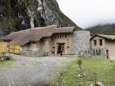
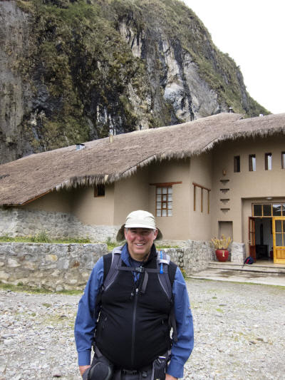
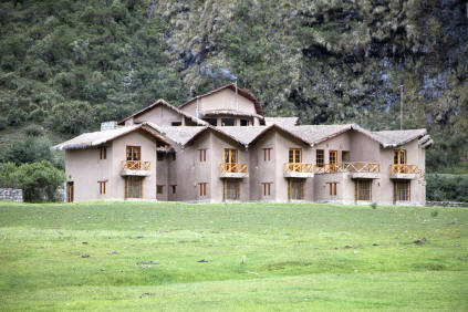
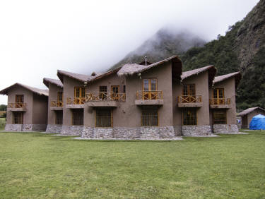
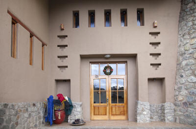
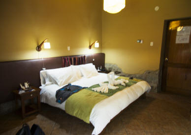
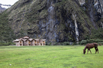
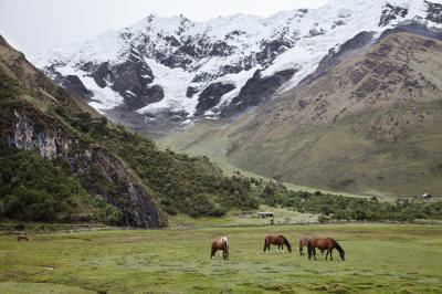
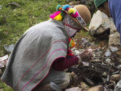
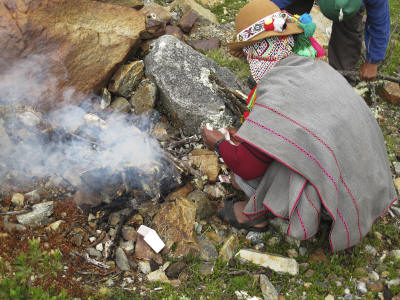
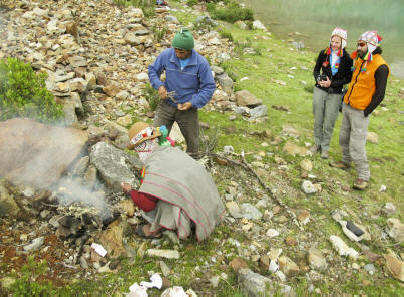
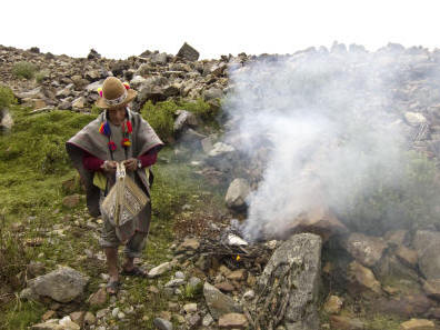
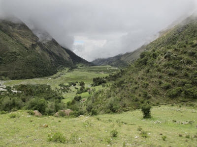
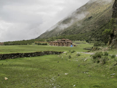
have Peruvian dance music for hand shaking the cocktails. We arrive at Wayra Lodge before 4pm. This lodge houses half of the number of people (6) as the Salcantay Lodge thus it is smaller and much more intimate. Of course, since we are the only guests on our particular trip, the staff is very attentive. They all are local people who have been trained by the company in staffing service positions. As soon as we settle into the lodge, Jon is approached by the masseuse for another afternoon session. Dec 18 – Sun. Last night is rained very hard at Wayra Lodge. But the
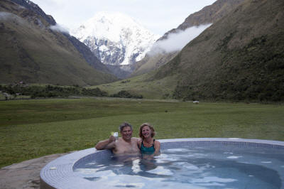
benefit was that the fog moved up and we were actually able to see the lodge
in-situ. The landscape is reminiscent of Scotland with the rolling green hills
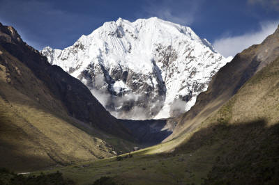
and damp, misty climate. We set out around 8 AM for a 4 hour hike following the
Salcantay River. We descend ~4000 ft from the glacier cloud forest down into the
rain forest ecosystem. Along the way, we see a mix of wild bamboo and rubber
trees, 4 types of wild orchids, many types of ferns and snapdragon varietals. As
one spot, Huamantay Peak’s north face is visible briefly. It is often speculated
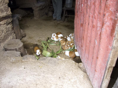
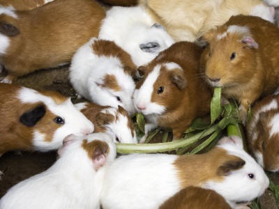
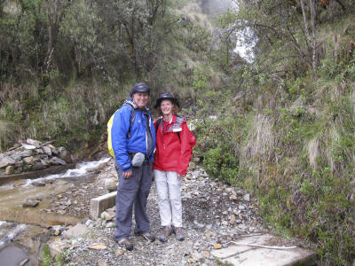
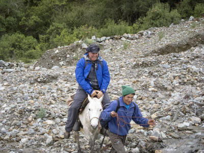
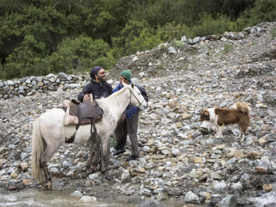
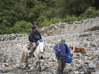
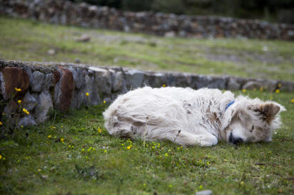
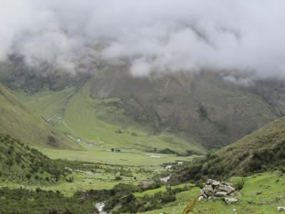
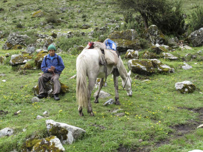
to be the model for the “Paramount Pictures” logo. Dec 19 – Mon. We take off early in the morning from Colpa Lodge and head down the Santa Teresa Valley passing through the confluence of 3 major rivers before merging into the main downstream gorge. In route we cross numerous small streams and pools of waterfalls crashing down from the high glacial runoffs. Since it has been raining for a number of days, there have been rock slides and wash-outs on the trail. In one section we don hard hats for protection against falling rocks. Other times we scrambled hand-over-hand through rocks in order to rejoin the trail. All along, our horseman, Martine, and Chester, his dog, are following in our tracks. The trail we take is actually the ultimate escape route of the Incas from Machu Picchu to the Amazon jungle while under siege by Pizarro. As we are walking the route in reverse, it is still possible to see Inca stonework in walls and roads. We pass a number of small farms along the way that have chickens, ducks, turkeys, dogs and pigs. The guinea pigs are kept inside the homes. As we descend, we see more cultivation of tropical plants including large avocado, banana, passion fruit, papaya and coffee trees. A van picks us up near the town of Playa and transports us into the national park so that we can walk to the village of Lucmabamba. The well maintained Inca Trial is where we climb for half an hour through an avocado orchard until we reach the Lucma Lodge, situated along the LLactapata Inca Trail segment. Our total descent today is ~1,728 ft, the Lodge is ~7,000 ft. After settling in, we visit a local coffee farmer at his house. We approach
his home through the coffee trees foresting his land. All the beans are green
now but when they turn red, they will be harvested, the skins will be removed
and the beans dried ready for roasting. All the coffee raised in this area is
sold through the Coop Cocla as highlands organic grown coffee which is stronger
and more valuable. As we watched the guinea pigs eat leaves on the floor, the
farmer’s wife roasted in a ceramic pot a group of dried beans, ground them and
then brewed a great cup of java for us to taste. Dec 20 – Tues. Our plan is for an early start from Lucmabamba to Aguas Calientes, home of Machu Picchu. Jon woke up feeling under the weather but wanted to continue hiking. We plied him with Apple Gatorade and started the morning warm up hike of 1,971 ft uphill. Lets just say it poured rain all night and the day was a continuation of the same off-and-on. It was warm and humid as we slowly slogged upward in rain hats and tee-shirts. By noon, we had made it to the Llactapata pass. There are recently discovered Inca ruins under excavation. From this site, we are able to capture a great view of Machu Picchu and the Incan citadel from the southwest. We descend for less than an hour to an observatory in view of Machu Picchu and have a hot lunch of fish and potatoes (except for Jon who is still not feeling great). After lunch we continue down to the Aobamba River through a very steep, dense jungle-like forest in which a mixture of banana and coffee plantations appear randomly along the way. We cross the Aobamba on a hanging bridge and move toward the confluence with the Urubamba River which brings us to the hydroelectric train station where we are to take a train to Aguas Calientes. However, instead of boarding the train for the ride upstream to the village of Aguas Calientes, we learn that there has been a landslide and the train tracks are buried. Williams, our resourceful guide, gets on his cell phone (yes, there is reception in the middle of the mountains) to find out the status of our duffle bags and our porter responsible for our luggage. Our bags were to have come by bus but the road was washed out as well so the porter had to wait until they dug the road out and then carried our bags the remainder of the way. It wasn’t too long before our bags showed up at the rail station We had no real choice at this point. We had to walk the ~8 miles along the rail tracks to Aguas Calientes with our 2 porters and guide. Not what we had planned. It took about 2 hours with sunset looming to complete the hike up. We had a short stop along the way at a tiny little lodge for tea and hot chocolate. It absolutely pours rain for the last 55 minutes into town. We were dragging after 8 hours of hiking. We walk into the Inkaterra Machu Picchu Pueblo Hotel soaking wet at around 6:45 pm. The hotel is landscaped with lush gardens of ferns and orchids. However, we are focused on a hot shower and dry clothing. For dinner,we met Willaims in the hotel and we all were half asleep during the meal. Long day, good outcome. Even Jon felt better after a miserable day. Dec 21 – Wed. Needless to say after yesterday’s 14 mile excursion we did not jump our of bed at the crack of dawn to get to the site of Machu Picchu. The weather report is quite repetitive in this region – rain. A few words about the Inca trail. It was an extensive network of stone roads,
15,550-18,650 miles, one of the most famous sections links Machu Picchu with the
Sacred Valley. Along the way the trail passes citadels,
hanging bridges and loud
forests sprinkled with lush plants as orchids and ferns. We board the national park supported bus up to the mountain site and arrive about 20 minutes later at the Machu Picchu Lodge and visitor entrance. History states that this site is the best-known Inca site in the modern world which was not discovered until 1911 by Hiram Bingham of Tiffany Jewelry family working with Yale University. His curiosity and perseverance with the local people led him to the now famous site although it visually was very different at the time since it was extremely overgrown. The lost city of the Incas, Machu Picchu, is sited at 7,710 feet on a mountain saddle high above the Urubamba Valley. It’s purpose remains a mystery although there is speculation that it was a place of worship, a place for tracking stars and seasons and a retreat for the ninth Incan emperor, Pachacutec. The architecture is a combination of in-situ granite and highly polished blocks fitted precisely in place. The more important the facility, the more elaborate the masonry. Besides the normal city functional buildings of homes, crop terraces, storage areas and extensive water system, there was a royal section for the emperor and his entourage (concubines, servants, etc) as well as multiple temples for sun, condor, three windows, etc. The mountain rising above the city was the Sacred Rock used for an alter to gods. We climbed the 1000 ft steep, narrow formation of Waynapicchu to view the city and surrounding river valley. From this vantage point we were able to see the mud slide on the rail tracks. Rain eventually drove us back to the metropolis of Aquas Calientes, named for
its natural hot springs, but economically sustained by tourists mostly of the
backpacking genre. We walk through the town observing soccer fields filled with
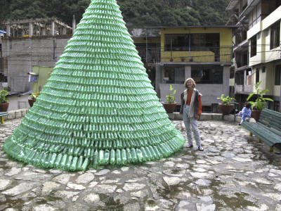
young and old. In one square a Christmas tree created with Sprite plastic
bottles caught our eye. But mostly the markets were filled with articles
appealing to the universal youth hostel travelers. Dec 22 -Thur. It has been pouring rain all night and continues this morning. Care is feeling a little queasy so her energy level is lower then usual. We prepare for the train ride down the Urubamba Valley. Since there are no roads into Aguas Calientes there is a strategic relationship between the train and the town. Our 1 1/2 hour ride to Ollantaytambo is very similar to our experience of walking into Aguas Calientes two days ago except this time we are riding and the rail cabin crew entertains us with dancing, a fashion show of local products and snacks. When we arrive at the station, we are not picked up for the drive back into Cusco so must spent an hour working with Mountain Lodges of Peru to get us on our way with a local driver. Cusco is ready for the holidays with decorations, lighting, firecrackers and lots of people socializing in the squares. On to the Amazon |
|
|