August was mostly taken up with preperation for an beginning our trip to the High Arctic Archipeligo: Canada and Greenland.
High Arctic Archipeligo: Canada and Greenland.
In 2003, we took an expeditionary cruise to Iceland and East Greenland on the National Geographic Endurance. We got a taste of the high arctic in East Greenland but did not see much wildlife or culture. A few months later we took a month-long Epic Voyage to Antarctica, also on the Endurance. That trip tooks us deep along the Antarctic coast and we saw a part of the world most people don't get to experince. We also saw some of the explore huts and lots of wildlife (but no culture since humans don't live there - except for imported research scientists). We decided to take the trip, the High Arctic Archipeligo: Canada and Greenland, to see more of the High Arctic. We were not dissapointed. We travelled roughly 4132 nautical miles (7652 kilometers) through the high arctic islands of Nunavit, Canada and then down the West Coast of Greenland. We saw lots of wildlife (14 polar bears, musk ox, arctic hare, walrus, narwals, seals, caribu, and lots of birds. We stopped at several small arctic settlements in Nunavit and Greenland and a few towns along the west coast of Greenland. We made it as far north as 80ojust 10osouth of the North Pole. We saw lots of ice and tundra and traced the historic routes of those trying to find the Northwest Passage. We had a great time and learned a lot.
Click here to see the voyage portfolio put together by National Geographic. It includes daily expedition reports, staff biographics, and a guest slideshow of pictures contributed by our fellow guests on the expection.
See below for the voyage map of our journey, compiled by our assistant expedition leader, followed by a slideshow of guest photos compiled by our photo instructor. They are followed by a day by day journal of photographs and videos of our trip.
Voyage map courtesy Andy Wolff, Linblad Expeditions
Photos courtesy of the guests of the National Geographic Endurange High Arctic expedition.
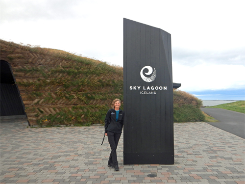
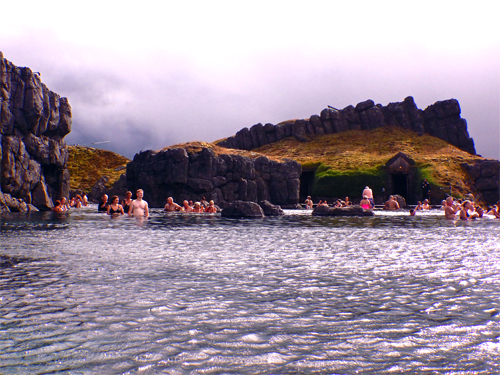
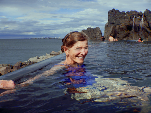
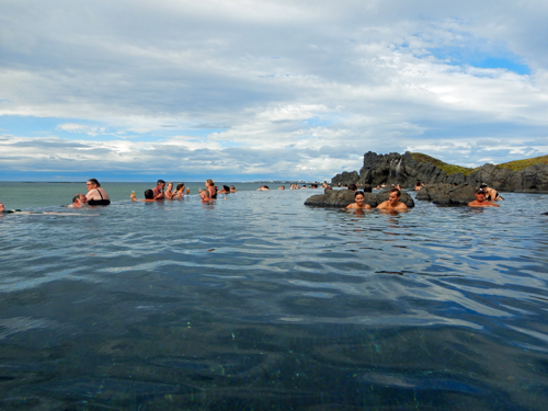
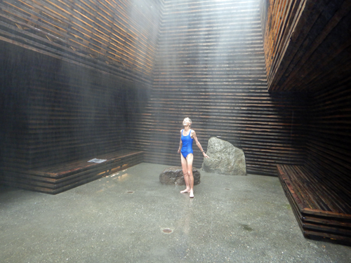
Reyjkavik - Sky Lagoon
We began our journey in Iceland, we flew in to Reyjkavik where we would spend the night before taking a chartered flight to Greenland to start our expedition. While in Reyjkavik, we visited Skylagoon, a hot springs spa on the outskirts of Reyjkavik. It is relatively new and easy to get to from town. One of Jon's architectural school classmates was involved in the design. We booked the Skjól Bathing Ritual, which we did after relaxing in the hot springs, which overlooks the water. Afterwards, we went back to our hotel and met up with friends for dinner. Here is Care's Rizbee on the Road blog for Reyjkavik and Sky Lagoon
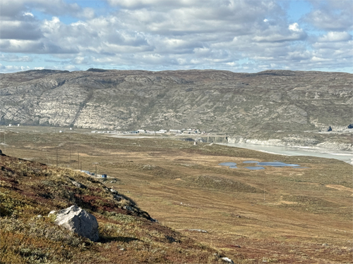
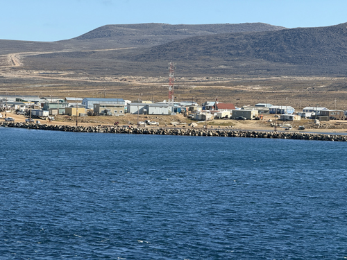
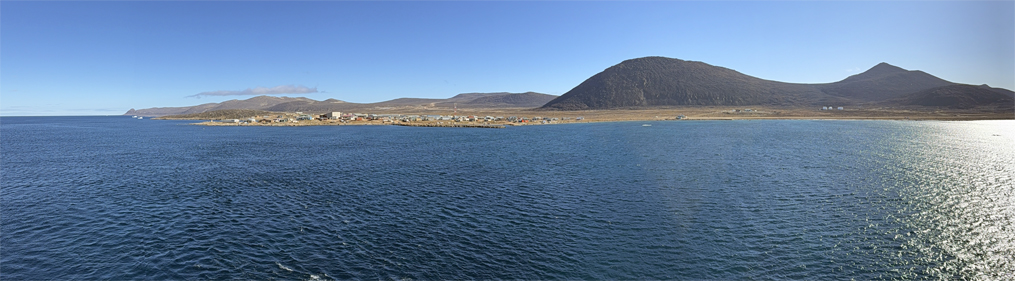
Kangerlussuaq
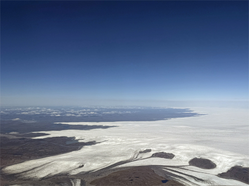
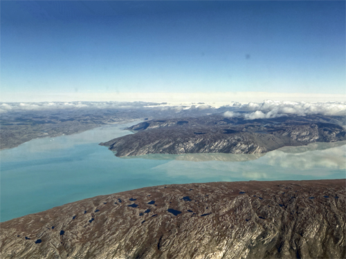
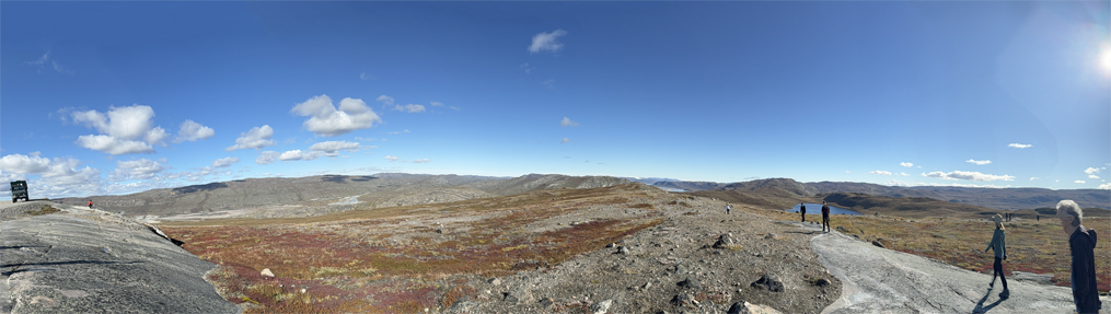
We woke up the morning we were to fly to Nuuk, the capital of Greenland. There was a buzz around our group and it was clear something was amiss. In a move right out of Borgen, the Danish government decided that Nuuk airport did not have adequate security and shut down international flights. This was a problem since we were supposed to meet our ship, the National Geographic Endurance in Nuuk, and passengers disembarking the Endurance were to meet our charter flight and fly back to Iceland. Our National Geographic/Linblad staff were working feverinshly on an alternative. What we ended up doing was to fly to Kangerlussuaq, the old international airport, about 200 miles north of Nuuk. Prior to the opening of the Nuuk airport, Linblad used Kangerlussuaq as their embarkation/debarkation point to it had the infrastructure to support us. We flew to Kangerlussuaq across the Greenland ice sheet. The town and airport are at the end of a long fjord. THe ship sailed up from Nuuk to meet us. After we landed and went through the very minimal (a danish immigration officer and a drug-sniffing puppy)! security, we did a short tour of the Kangerlussuq area including a view of some musk ox. We then boarded the Endurance with our luggage and fresh supplies from the hold of our charter plane and were off on our expedition. Despite the drama, the expedition staff and ship's crew did a great job adapting to the situation and we proceeded with minimal disruption. Here is Care's Rizbee on the Road blog for Kangerlussaq.
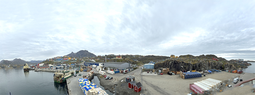
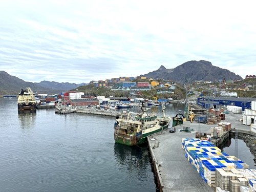
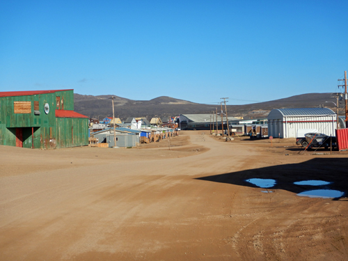
Sisimiut
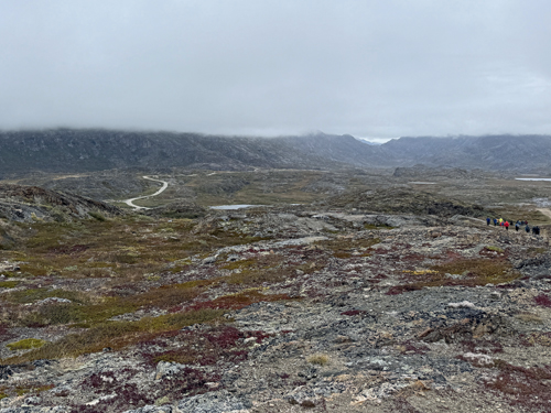
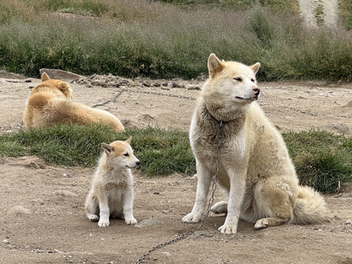
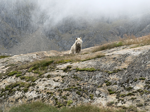
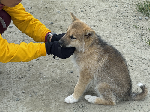
Our first stop was the Western Greenland town of Sisimuit. The town is the second largest in Greenland right on the Arctic Circle. We took a hike outside of town and went though an area called Dog Town, where the locals keep their working dogs - mostly Greenlandic Huskies. We were told to stay away from the adult dogs - they can be dangerous - but several puppies were around and very curious. They came up to us to investigate and play. Needless to say, Care was very excited. The hike was over tundra. We got some views of the town but as we climbed up the hill, we got encased in fog.Here is Care's Rizbee on the Road blog for Sisimiut.
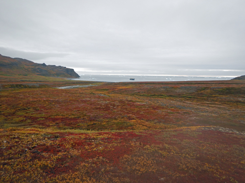
Disko Bay
Disko Island is the largest island in Western Greenland. We hiked across the mushy tundra - like hiking on pillows, and in the afternoon did a zodiak tour. That night we went around Disko Island and anchored in a foggy inlet the next day, a lazy day. THe next night we made our way across Davis Strait. Here is Care's Rizbee on the Road blog for Disko Bay.
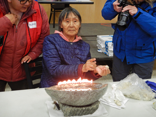
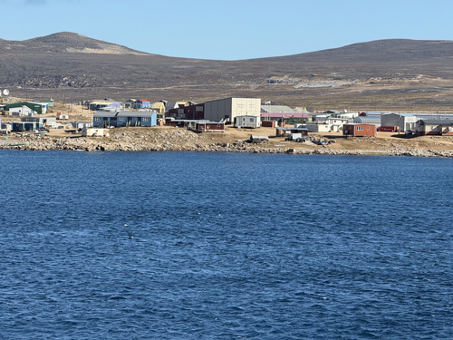
Qikiqtarjuaq
We cross Davis Strait from Disko Island in Greenland to the Canadian Territory of Nunavit. We land in a small town called Qikiqtarjuag. We have to wait until Canadian authorities board our ship to clear us through customs and perform a health inspection of the ship. After we clear customs, we take zodiaks ashore to Qikiqtarjuaq, where we have a presentation by the locals at the community center - with tasty treats of Narwhal and Arctic Char. We then wander about the town before returning to the ship to begin our journey north along Baffin Island. Here is Care's Rizbee on the Road blog for Qikiqtarjuag.